Explore Niwot: Four Places in Walking Order
Old Town first, then Cottonwood Square, then whatever the weather allows. The whole loop is under two miles.
Old Town
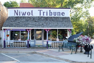
The brick and false-front commercial block on Second Avenue is the reason the rest of this page exists. It dates from the railroad period and it is still where the community gathers.
Walk it end to end in about ten minutes. Cross streets are short and the sidewalks are continuous.
- Getting there
- Street parking along Second Avenue and the adjacent lots.
- Best for
- Coffee, browsing, and the historic building fronts.
Cottonwood Square
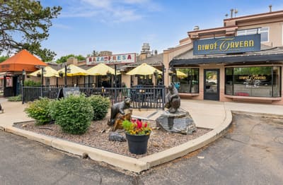
The second cluster of shops and everyday services, north-east of Old Town. Less historic, more practical, and where a lot of residents actually run errands. Two bronze bears sit on the corner.
- Getting there
- A short walk or a two-minute drive from Old Town. Lot parking.
- Best for
- Lunch on a patio, and the practical errands.
Public art
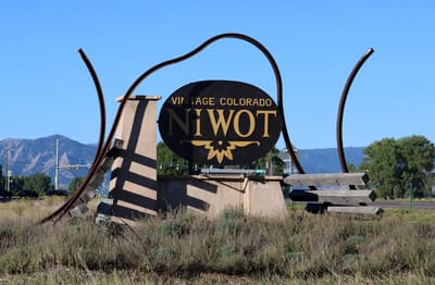
The steel gateway sculpture stands at the highway edge of the community, an oval sign held inside two curving rails. Further works are sited around the commercial blocks, close enough to see on the same walk.
The Niwot Sculpture Park, run by the Niwot Cultural Arts Association since 2018, shows sculptures the association has bought or been given alongside pieces lent by artists for a year at a time, chosen by the park’s committee. The association’s site lists the current pieces.
- Sculpture park
- Niwot Cultural Arts Association
Individual works are named here only with a verified title, artist and location. Send one and it goes in with artist credit.
Parks & trails
Whistle Stop Park sits at the south-west corner of Murray Street and First Avenue, at the edge of Old Town, and keeps the restored caboose. The Longmont-to-Boulder (LoBo) Regional Trail — twelve miles between the two cities through Gunbarrel and Niwot — runs through the community and joins the local trail network, and Left Hand Creek crosses the fields east of the built-up blocks.
Trail surfaces, closures and dog rules are set by Boulder County Parks & Open Space rather than by a town, since Niwot is unincorporated. The county’s trail page carries the map; its Niwot trails map shows the local connections.
- The trail
- LoBo Regional Trail, Boulder County
- Local map
- Niwot trails map, PDF (county, 2017)
- Closures and rules
- Trail closures and alerts · Open space regulations
- Best for
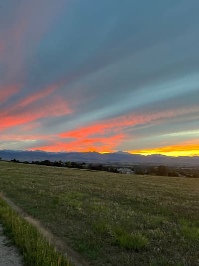
- Walking and cycling; the eastern fields at sunset.
Getting here, and how the place came to be
Directions, parking, transit and what can be confirmed about accessibility are on the visitor page. The railroad, the 1875 plat and how Niwot stayed unincorporated are on Our Story.